Severe Weather, Including Possible Tornadoes, to Impact Central Florida Tomorrow
Since Disney World is located in Central Florida, it is no stranger to severe weather. Extreme heat, random thunderstorms, and even hurricanes impact this part of the state almost every year.


Hurricane season doesn’t begin until June, but that doesn’t mean there aren’t still very strong storms that happen around Orlando. And, it looks like those kind of storms will be impacting the area tomorrow.
Severe Weather in Central Florida
There is a threat of strong to severe storms in Central Florida tomorrow (Tuesday, January 9th), according to WESH. They’re reporting that the worst of the weather will likely be in the late afternoon and evening.


Part of Central Florida has been elevated to a level 3-5 risk for several strong to severe storms by the Storm Prediction Center. According to WESH, a 3-5 risk is not common and has only happened a handful of times in the past couple of year in Central Florida.
Because of this, Tuesday is now a First Warning Weather Day.


Cinderella Castle in foggy weather
According to WKMG, the northern half of Central Florida is in a level 3 (enhanced risk for severe thunderstorms) and the southern half is in a level 2 (slight risk). The southern half looks to be where Walt Disney World is located.
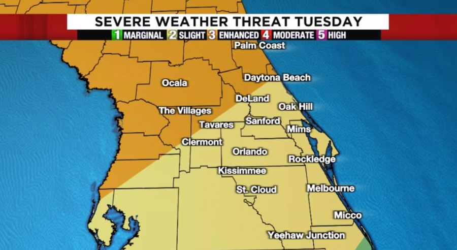

Photo: WKMG
Right now, it’s looking like there will possibly be non-severe thunderstorms early tomorrow morning. Then, wind gusts should become stronger leading up to the main line of storms.


The biggest concern is about the strong winds that could be damaging. There is also a concern for possible tornadoes and a strong tornado has not been ruled out.


WKMG is saying that winds without thunderstorms will be around 20-30mph with gusts that could be over 40mph. Do note that a wind advisory is in effect for all of Central Florida.
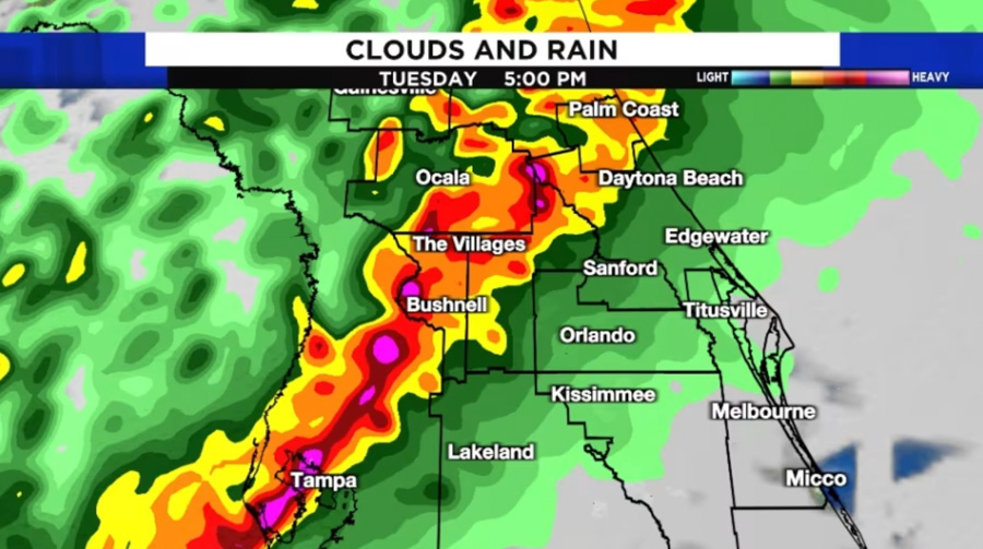

Photo: WKMG
The line of severe storms will move into the northeastern parts of Central Florida around 3-4PM tomorrow. They should be calming down and moving to the eastern coast by 8PM.
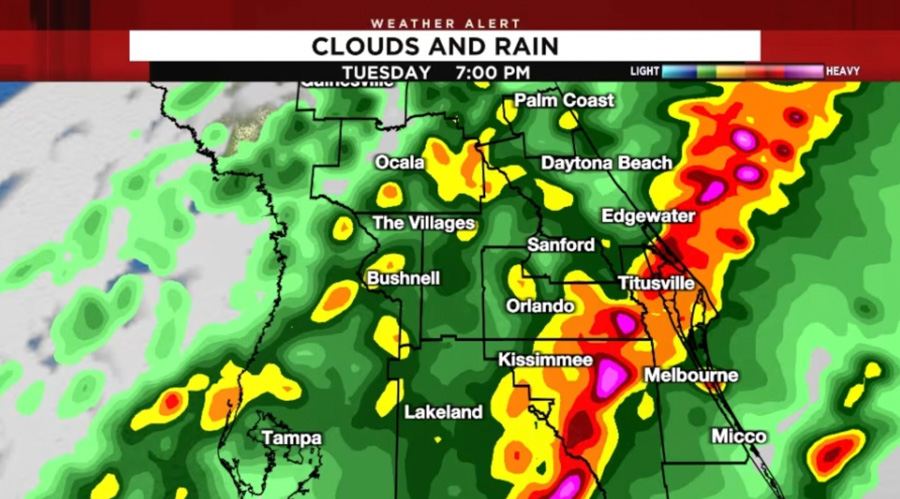

Photo: WKMG
We’ll keep you updated on this situation as it develops.


