
Tornado Warning Issued for Walt Disney World Area
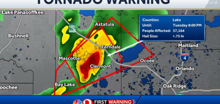
The National Weather Service has issued a tornado warning for parts of Orange and Brevard County.
This warning will cover southeast Orange and northwest Brevard counties and last through 5:15 EST.
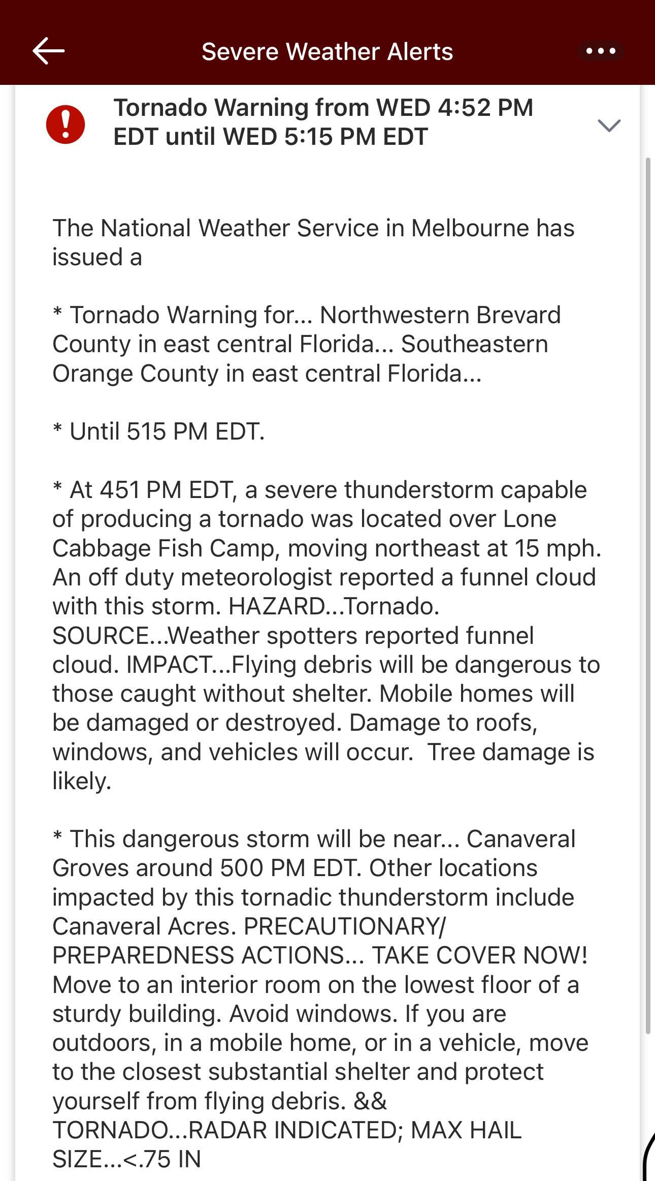
Image: National Weather Service
According to a weather alert, the National Weather Service spotted a funnel in the area that was capable of turning into a tornado.
Central Florida has experienced stormy weather all day. Current forecasts suggest that rain will continue until 7 p.m. EST tonight.
However, the tornado warning is much more concerning. Although the timeframe has technically passed now, it’s something to bear watching for the next hour or so.
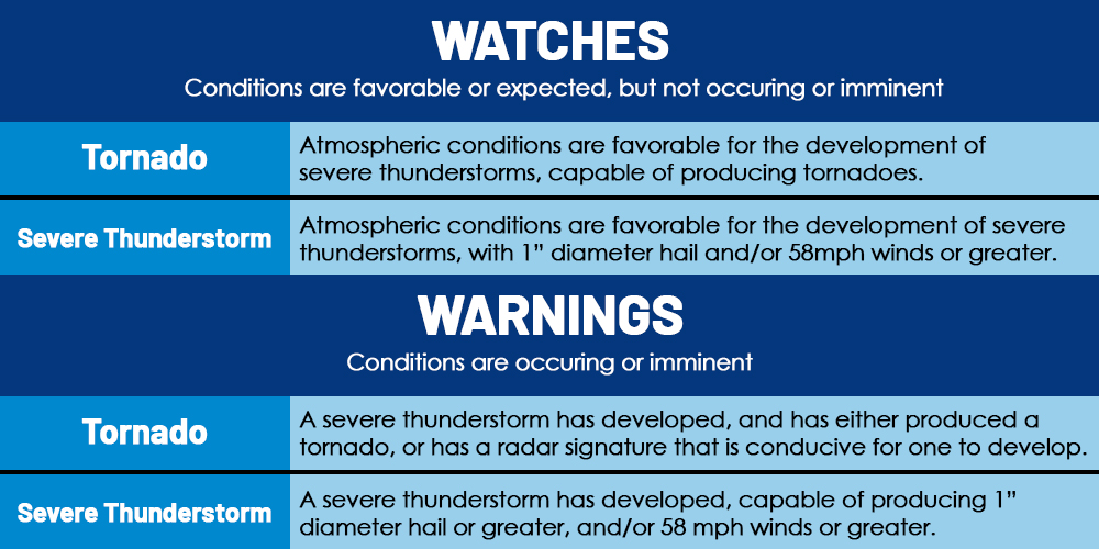
Image: WeatherWorksInc.
As the above graphic indicates, a warning generally indicates the most dangerous weather conditions unfolding.
These two sections of Central Florida are currently experiencing atmospheric conditions and thunderstorms so severe that they’re conducive to a tornado.
Those of you in the impacted area should pay attention to weather alerts. It’s probably not a bad idea to stop what you’re doing and seek shelter for an hour or two, either.

Photo: MickeyBlog
Thanks for visiting MickeyBlog.com! Want to go to Disney? For a FREE quote on your next Disney vacation, please fill out the form below, and one of the agents from MickeyTravels, a Diamond Level Authorized Disney Vacation Planner, will be in touch soon!


Central Florida residents need to keep a close eye on the weather forecast as a severe weather threat looms over the region.Wednesday afternoon and evening, showers and storms are expected to fire up, with some of them potentially becoming quite strong. Up to a 70% coverage of rain is expected. The threat of severe weather is expected to extend into Thursday, from late afternoon through overnight hours and into Thursday morning.